The West Branch of the North Fork

AlanLichty

Moderator
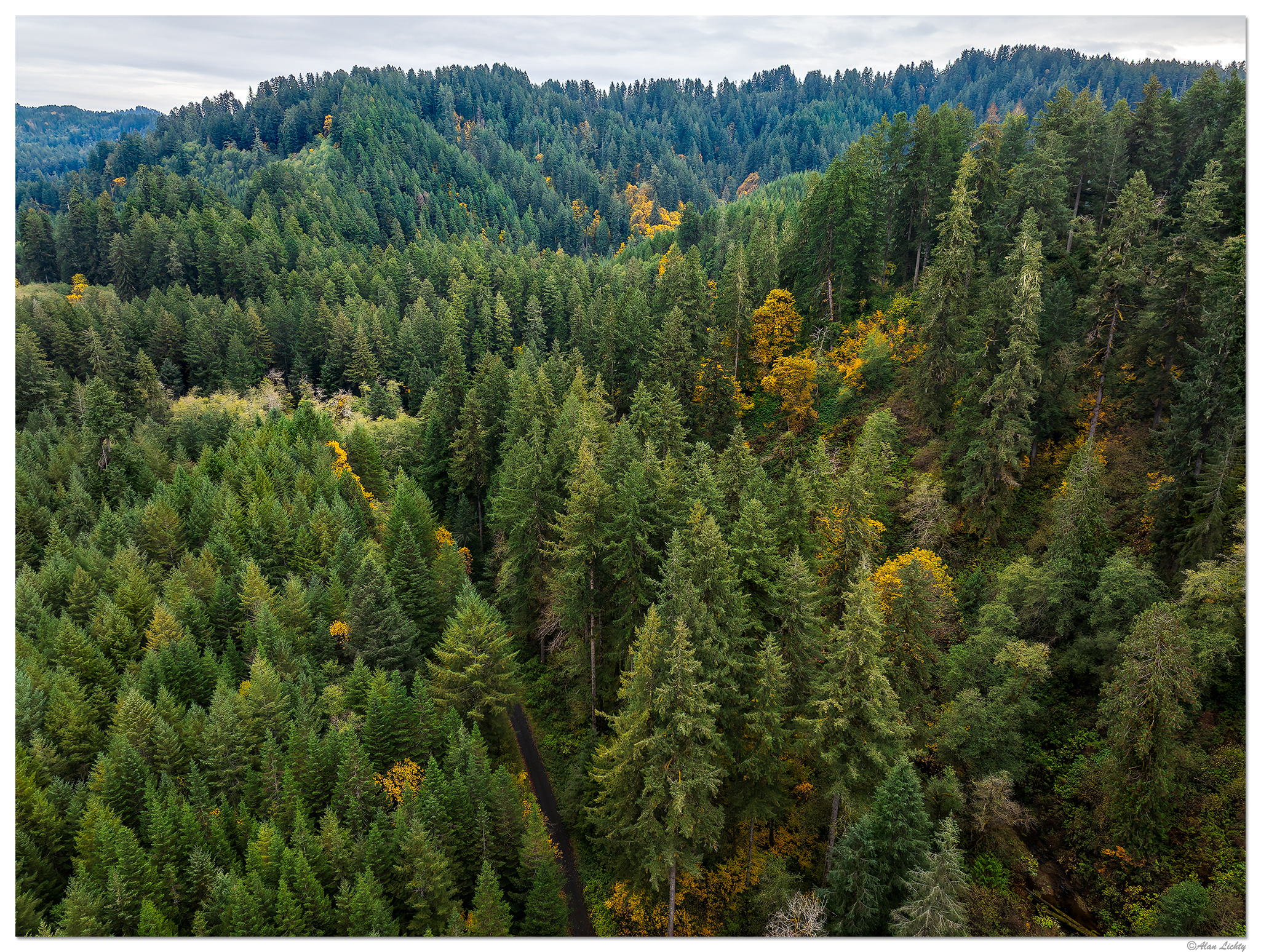
This pair of shots are a drone's view of the Suislaw National Forest near where Sweet Creek Road joins the North Fork of the Smith River Road. They show quite clearly why you don't get much of a view of the terrain from down on the road itself with the trees towering over the roadway. The road right at this location is actually paved although only a single lane wide. Most of the road between the top of the waterfall area along Sweet Creek up to this location is single track gravel but there were a couple of seemingly random stretches with asphalt. I tried to get my drone up above the trees every chance I could along this road but finding spots with a break in the tree canopy and a place to pull off the road weren't easy to come by. As it turned out I never saw anyone along the roads in the higher elevations at all that afternoon and probably could have just stopped in the middle of the road.

Looking almost straight down:

DJI_M3P_24_SCR-NFRd2102825.jpg


The distant ridge line in the upper left of this next scene marks the delineation of watersheds feeding the Siuslaw River to the north and the Smith River drainage that flows into the Umpqua to the south.

DJI_M3P_24_SCR-NFRd1102825.jpg


C&C always welcome.
 

Peter Michal

Well-Known Member
It's beautiful to see trees and forests from above, unusual for us terrestrials. It must be challenging to operate the drone correctly and anticipate a good shot..
The names of the rivers and places you took pictures of are completely unknown to me.. I have to look them up on a map. Nice colors, I like both photos.
 

AlanLichty

Moderator
It's beautiful to see trees and forests from above, unusual for us terrestrials. It must be challenging to operate the drone correctly and anticipate a good shot..
The names of the rivers and places you took pictures of are completely unknown to me.. I have to look them up on a map. Nice colors, I like both photos.
Thanks Peter - when I am driving along a road like this one I had no idea of what to expect for a view since all I saw from the ground were tree trunks. Here is a terrain map showing where I was shooting on the day I took the shots above with the yellow marker showing the location of these shots.

1763738125477.png
 

AlanLichty

Moderator
Wow Alan, there just isn't a break in the canopy! Or just a sliver.
Thanks Jim - that sliver is only because the USFS downed a line of trees for the road. This is almost wide open compared to up by the Kentucky Falls trailhead. If you tried flying around above the treetops you wouldn't have a view of the drone at all from the ground and the given is that you have to find the hole again from above in order to land. It's pretty critical to make sure you have satellite position lock before you do anything. The other alternative is to just go straight up and just pan the drone around to shoot and come straight back down which is what I was doing in these forests.
 

Jameel Hyder

Moderator
Staff member
Quite a dense forest. The roads provide a way to launch the drone. Sometimes it’s hard to get a lock on the position with the tall trees. Flying straight up and down is a prudent way to fly.
 

AlanLichty

Moderator
Quite a dense forest. The roads provide a way to launch the drone. Sometimes it’s hard to get a lock on the position with the tall trees. Flying straight up and down is a prudent way to fly.
Thanks Jameel - I made a point of being patient waiting for the drone to get a position lock before heading up even though I knew I wasn't going to fly anywhere but straight up. Once you get up in the air you can lose track of your launch point almost immediately since the tree cover all looks the same from the air. No way you would ever be able to recover the drone if you wandered from your launch point without knowing where the home point was.
 
Top Bottom