The Knot at Bowknot Bend

MonikaC

Well-Known Member
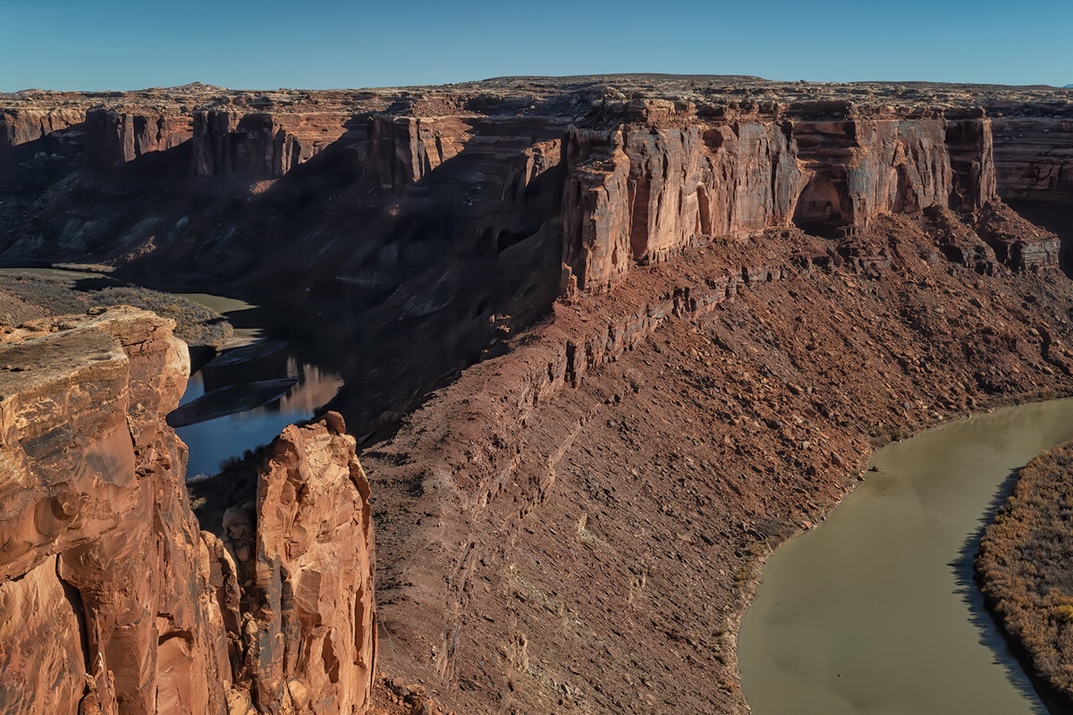
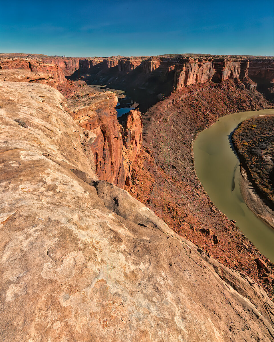
I spent Thanksgiving back in Labyrinth Canyons Wilderness Area. This time I hiked out to the overlook for Bowknot Bend. I wish there was a way to get down 1 more level, but without a rope & ascenders to get back out, it's not a go. It's an 8-mile hike (RT). No trail, just enough cairns to let an old desert rat know she's on the right track. For the drone owners, this will probably make you drool (if drones are allowed in Wilderness). The bend (out of sight, behind the butte on the far side of the notch) is 8 river miles long to go just under 1/2 mile as the crow flies. If someone doesn't want to float all the way around, they can be let off upriver, hike up & over the notch and rejoin the boat as it comes around downriver. It looks steep & loose enough that stiff, high-topped boots and poles just might save ones ankles. Tom Till has a picture of this taken from the Canyonlands side (probably Spring Canyon road/Deadman Point area) that shows the whole bend. Even though it was late morning, I still got nice warm colors on the right side as the sun was so low. Land of long shadows.

Bowknot-Rock-Removed-DustNoiseSharpNik.jpg


BowknotNotchCropNoiseSharpNik.jpg
 

AlanLichty

Moderator
Crazy piece of real estate. I have "visited" this place many times in aerial and satellite imagery always being amazed at the tortured path of the river and your on the ground views add a sense of scale I did not have before. Very cool.
 

Jim Dockery

Well-Known Member
Looks like a cool place. No droning in wilderness areas though. Funny that you can fly in a plane or helicopter there if you can afford it though.
 

MonikaC

Well-Known Member
Crazy piece of real estate. I have "visited" this place many times in aerial and satellite imagery always being amazed at the tortured path of the river and your on the ground views add a sense of scale I did not have before. Very cool.
I thought this area might not be too far from the dig you told me about where the artifacts were extremely well preserved (something about how the leather was still so supple, the knots could be untied) but got looted due to careless words in a bar in Green River.
 

MonikaC

Well-Known Member
Looks like a cool place. No droning in wilderness areas though. Funny that you can fly in a plane or helicopter there if you can afford it though.
Straight across the river, it's BLM, just north of national park boundaries and county maintained roads, so one might be able to fly a drone from that side?
 

AlanLichty

Moderator
I thought this area might not be too far from the dig you told me about where the artifacts were extremely well preserved (something about how the leather was still so supple, the knots could be untied) but got looted due to careless words in a bar in Green River.
Not far at all as a crow flies but you have already described the issues with following that path on the ground :) We were upstream from Horseshoe Canyon which joins the Green River very close to where you shot these images. Spur Fork is the specific area for the Cowboy Cave excavations.
 

JimFox

Moderator
Staff member
This is so cool Monika! What a fun area to explore. Those spires and the River curve are just so photogenic.
 
Top Bottom