Rick and I met in Monticello on a Sunday afternoon. We then drove out the road to the Needles district and a few miles past Newspaper Rock we turned south on a variously named road, that we called Beef Basin East.
This road is a country road that you could drive in a sedan in good weather. It was 25 miles to a place that started Beef Basin road proper. That was in timbered country and 8200 Feet. A beautiful drive.
The next day we intended to follow that road to a place named Ruins Park and then onto Bobbies Hole. A notorious road that leads to the Devils lane portion of the Elephant Hill road.
But that first night was just an exploration and we turned around and drove back to Monticello. On the way we had a tremendous thunder storm and heavy rain. But we had no trouble and no fears of Mondays drive.
On Monday. We drove out to the Needles district for some sunrise and then back to Beef Basin Road. As we got a few miles in, it started to rain. This time the clay surface got very slick and our vehicles were all over the road even in 4WD, After crossing the pass and starting down Rick stopped and said what should we do? I said, turn around. At some point one of us got stuck in a water filled ditch and it took about 45 minuted to dig our way out.
We got over the pass and heading back down when we encountered 4 vans in the act or turning around. Another 45 minute delay.
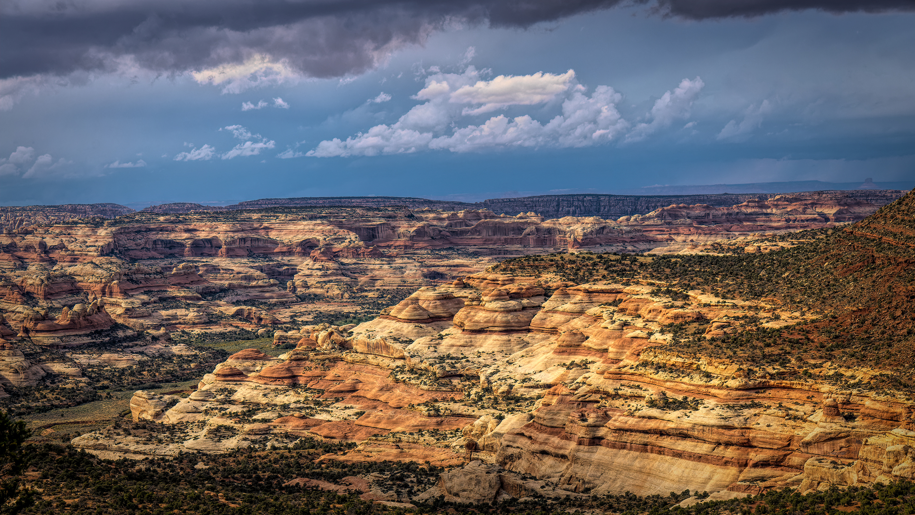
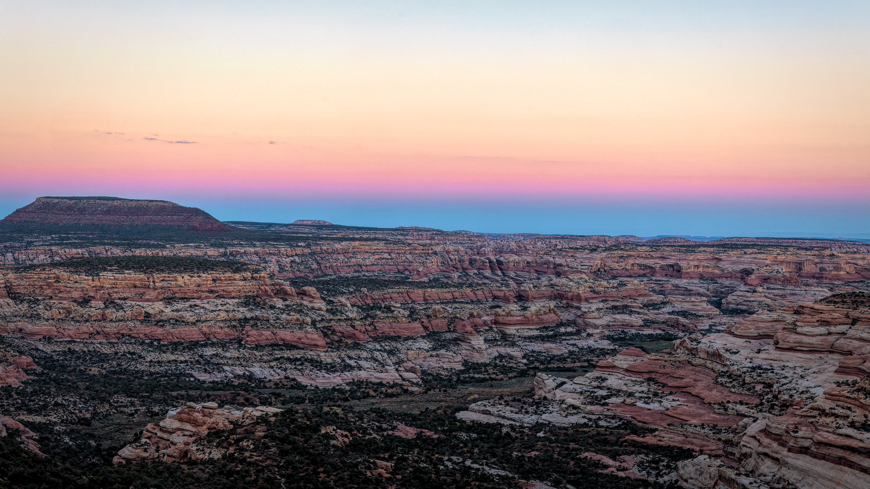
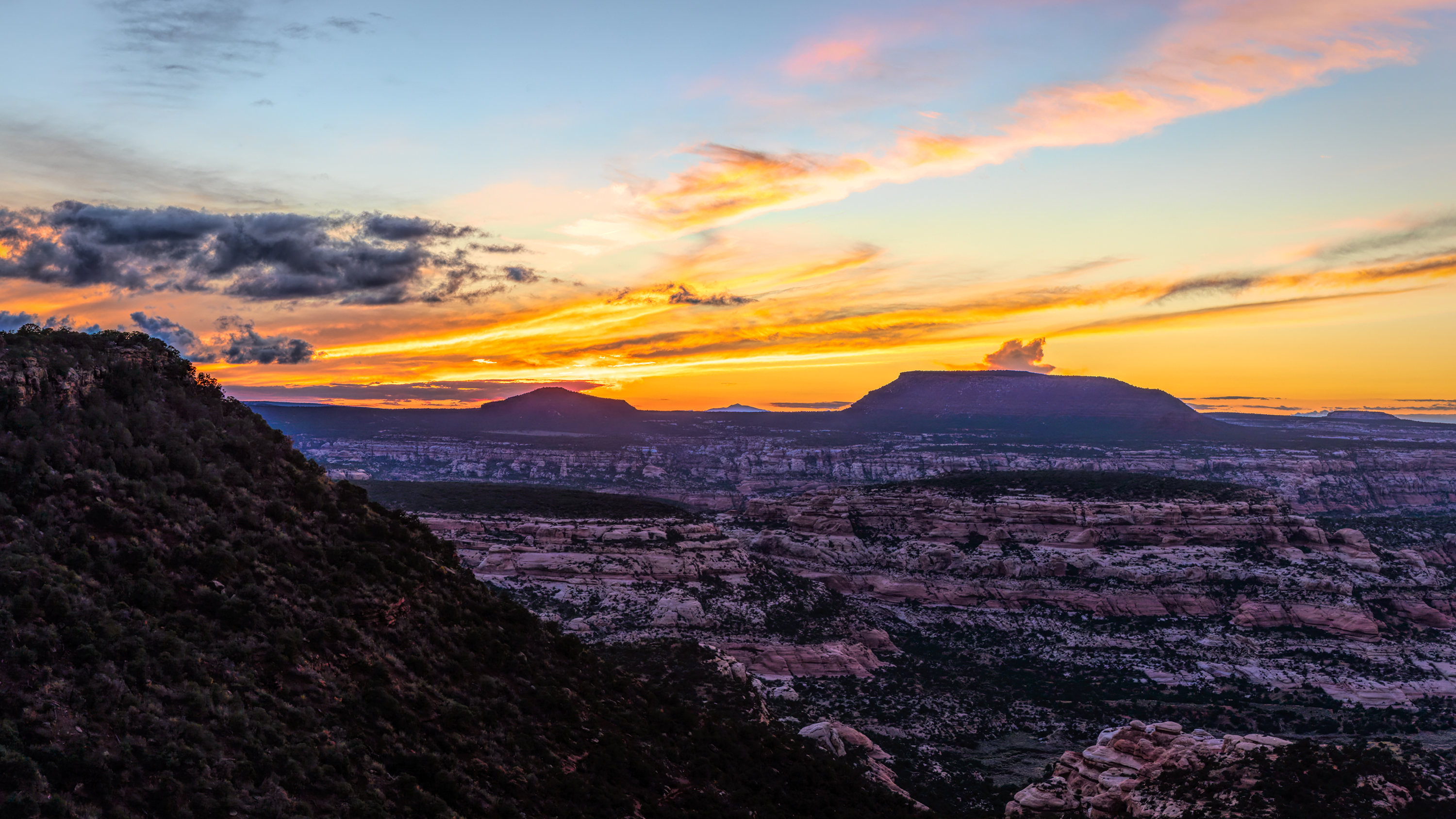
By then the rain had stopped, but the road was so slick you could barely walk on it and our boots had a few pounds of mud on them. But we had intended to camp that night next to a place called Salt Valley. So we camped and were able to get these images.
1
2.
3.
This road is a country road that you could drive in a sedan in good weather. It was 25 miles to a place that started Beef Basin road proper. That was in timbered country and 8200 Feet. A beautiful drive.
The next day we intended to follow that road to a place named Ruins Park and then onto Bobbies Hole. A notorious road that leads to the Devils lane portion of the Elephant Hill road.
But that first night was just an exploration and we turned around and drove back to Monticello. On the way we had a tremendous thunder storm and heavy rain. But we had no trouble and no fears of Mondays drive.
On Monday. We drove out to the Needles district for some sunrise and then back to Beef Basin Road. As we got a few miles in, it started to rain. This time the clay surface got very slick and our vehicles were all over the road even in 4WD, After crossing the pass and starting down Rick stopped and said what should we do? I said, turn around. At some point one of us got stuck in a water filled ditch and it took about 45 minuted to dig our way out.
We got over the pass and heading back down when we encountered 4 vans in the act or turning around. Another 45 minute delay.
By then the rain had stopped, but the road was so slick you could barely walk on it and our boots had a few pounds of mud on them. But we had intended to camp that night next to a place called Salt Valley. So we camped and were able to get these images.
1
2.
3.
") I hate it when every step adds another pound of mud to what's already stuck on your boots. Neat little valley with Aimee colorful formations. Nice sunset too.
I hate it when every step adds another pound of mud to what's already stuck on your boots. Neat little valley with Aimee colorful formations. Nice sunset too.