AlanLichty
Moderator
I have hiked the trail leading up to the base of Elowah Falls in the Columbia River Gorge on quite a number of occasions and always lamented that while I could hear a lot of small waterfall features along McCord Creek from the trail it was almost impossible to even view the creek think less of finding a way to shoot it. On one visit to the area I took a detour off of the trail and did some serious bushwhacking to get to a spot with a bit of a view from a rather precarious spot and got this shot looking upstream:
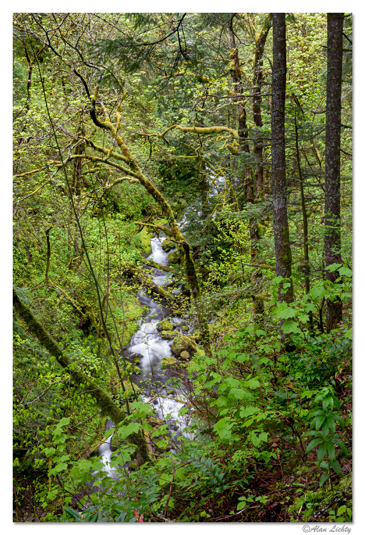
I kept wishing there was a way to get a better view. As the thread title says - be careful what you wish for.......
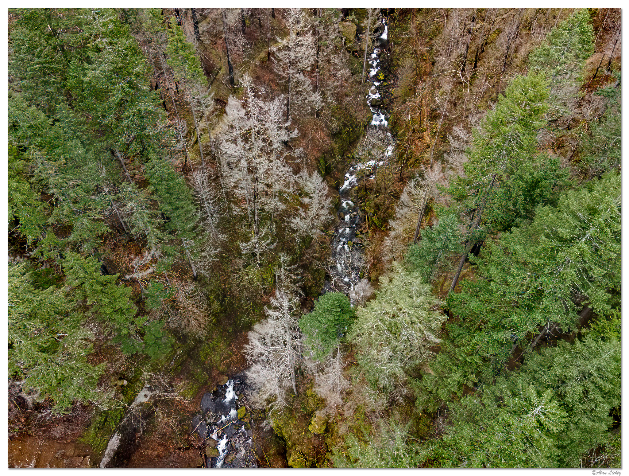
On Thursday I went up the Gorge to visit this area but the trailhead is closed due to a small landslide near the parking area so the aerial view is all I can get for now. I was able to get to a pedestrian bridge along the Historic Columbia River Highway State Trail which gave me a clear launch site for my drone. For the record I have checked the USFS site for no fly zones and this area is not included. Since the trailhead is closed there was no one below where I was flying.
My first thoughts on seeing the scene was that the Eagle Creek Fire damage wasn't as bad as the descriptions I had read, After looking over the shots I got that optimism appears to have been premature. There are some green trees amongst the snags left standing but the ground level vegetation has been completely scoured and even after 4 1/2 years moss and ferns are the only real pioneers visible on this moonscape.
In the shot below the trail can be seen on both side of McCord Creek with a switchback just barely visible through the green trees off to the right. The point where the shot above was taken is just up from the bottom in the center where the creek does a bit of a zigzag looking up towards the top of the frame. Click through for a larger and more detailed view.
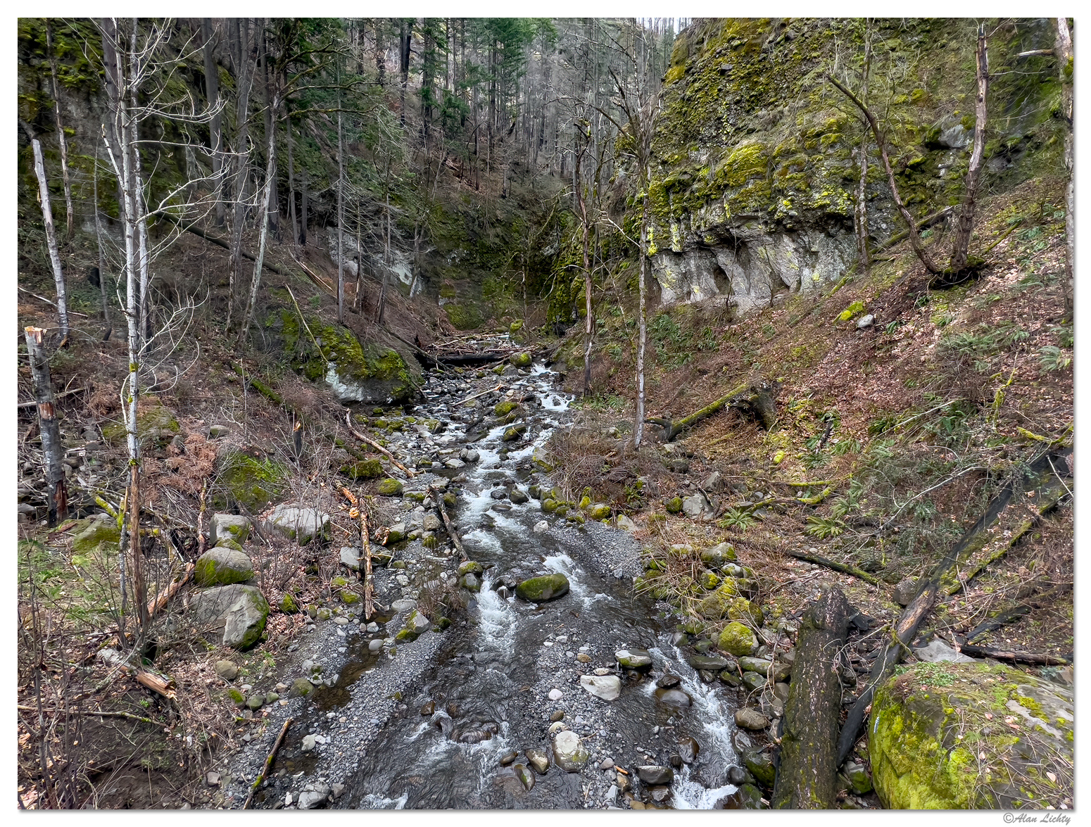
One more shot of McCord Creek just above the Historic Highway trail bridge looking upstream taken Thursday. It might be a while before McCord Creek gets fully revegetated and certainly not within my lifetime.
C&C always welcome.
I kept wishing there was a way to get a better view. As the thread title says - be careful what you wish for.......
On Thursday I went up the Gorge to visit this area but the trailhead is closed due to a small landslide near the parking area so the aerial view is all I can get for now. I was able to get to a pedestrian bridge along the Historic Columbia River Highway State Trail which gave me a clear launch site for my drone. For the record I have checked the USFS site for no fly zones and this area is not included. Since the trailhead is closed there was no one below where I was flying.
My first thoughts on seeing the scene was that the Eagle Creek Fire damage wasn't as bad as the descriptions I had read, After looking over the shots I got that optimism appears to have been premature. There are some green trees amongst the snags left standing but the ground level vegetation has been completely scoured and even after 4 1/2 years moss and ferns are the only real pioneers visible on this moonscape.
In the shot below the trail can be seen on both side of McCord Creek with a switchback just barely visible through the green trees off to the right. The point where the shot above was taken is just up from the bottom in the center where the creek does a bit of a zigzag looking up towards the top of the frame. Click through for a larger and more detailed view.
One more shot of McCord Creek just above the Historic Highway trail bridge looking upstream taken Thursday. It might be a while before McCord Creek gets fully revegetated and certainly not within my lifetime.
C&C always welcome.
")