AlanLichty
Moderator
My father was always a photography nut and got me interested when I wasn't much more than a toddler. I consider my real start in photography to be in 1963 when I was given my father's old Minolta Autocord twin lens reflex after he acquired a Rolleicord TLR. My hero and inspiration came from the imagery of Joseph Muench on the pages of Arizona Highways while I grew up in the Phoenix area. A few years later I got my father's old Rolleicord TLR which I shot with up until the early 70's when the door on my old VW bus flew open in a turn on a northern Idaho highway. I looked in the rear view mirror and watched the camera bouncing across the roadway and onto the shoulder. I was able to scavenge the roll of film that was in the camera but that was the end of the line for the Rolleicord. I switched to 35mm with a Pentax Spotmatic in 1972.
In 1974 I started graduate school in Archaeology at the University of Utah and got formal training in using photography as a recording tool for excavation, artifact curation, and survey work. After several years of fieldwork in both Utah and the Middle East (Petra, Jordan and Egypt) I ended up working for the Utah Archaeological Center until 1994. My first major project at the Utah Archaeological Center in 1979 was to create a digital database of all of the survey and excavation records of work that had ever been done in the state of Utah on both public and private lands. Another PhD candidate and myself spent 3 years poring over all of the original records, photos and topo maps from every federal and state agency as well as the records on file at the U of U.
Some of the slides and photos we went through as part of that effort included images of places no one will ever see again including the photos taken by the teams that surveyed Glen Canyon in the 1950's before it was flooded by Lake Powell. Glen Canyon was without question the crown jewel of the Canyonlands area and to this day I resent the existence of Lake Powell. The University has been approached by magazines (including National Geographic) many times over the years for access to those survey slides but some legal reason has denied access. I felt lucky I got to go through them.
Most of my photography during that time was documentary in nature and quite a lot of it was using institutional cameras and film with everything catalogued and curated with either the Utah Archaeology Center or the Natural History Museum of Utah at the University of Utah. I traveled a lot in Utah as part of my work there and in a lot of places tourists still don't visit but none of it ever counted as vacation time. I bailed on the old thread mount system of the Pentax in the late 1980's and had a Nikon F2 for a few years but never really liked shooting with it. I switched over to a Canon EOS Elan and have been shooting with Canon EOS ever since.
I was finally ordered to take a real vacation since I had too much vacation time accumulated so my wife and I decided we should go visit a rain forest instead of the endless sagebrush and sandstone of Utah. Big mistake they made me do that because we immediately fell in love with the Pacific NW and decided to flee life behind the Zion curtain of Utah when I took a job in Vancouver Washington in 1998.
In 2001 I was unhappy with the photo labs in Vancouver so I decided to try editing my images on a computer instead so bought a Nikon Coolscan 4000 to scan my slides. I ended up using Silverfast software for scanning and Adobe Photoshop for edit work. While that did work for a while I noticed that Canon's new D60 DSLR with 6MP had almost the same number of lines as I was getting out of my slide scans at 4000dpi. All of the lenses I had for my EOS Elan would fit so I bought a D60 camera body and never looked back. Through the years since I have gone through quite a few EOS camera bodies (20D, 5D, 5D MkII, 6D, 5D MkIV, and now R5MkII). In an ironic twist I now use my digital cameras on a copy stand to scan my old slides.
I have always loved viewing aerial photography and added camera drones to my collection in 2022. I started with a DJI Air 2 but moved on with my current fleet consisting of a Mavic 3, Mavic 3 Pro, and a Mavic 4 Pro. My drones are quite capable of doing video work but I use them almost exclusively for still camera work and think of them as flying tripods. I don't really engage in commercial work with my drones but I have held an FAA Pt. 107 commercial drone pilot certificate for close to four years now.
I acquired almost a fetish for falling water ever since leaving the desert and while I do like to visit the Colorado Plateau area on occasions I have zero interest in moving back near there. My new love is for the deep dark forests of the Pacific Northwest and the amazing and almost endless waterfalls of the Columbia River Gorge less than an hour's drive from my house. I love the fact that I no longer depend on anyone's lab to process and view my work while being able to easily access the tens of thousands of captures I have taken through the years. Equally enjoyable for me is being able to participate in forums like this one where I can share my work and hopefully help others to improve their work and share it as well.
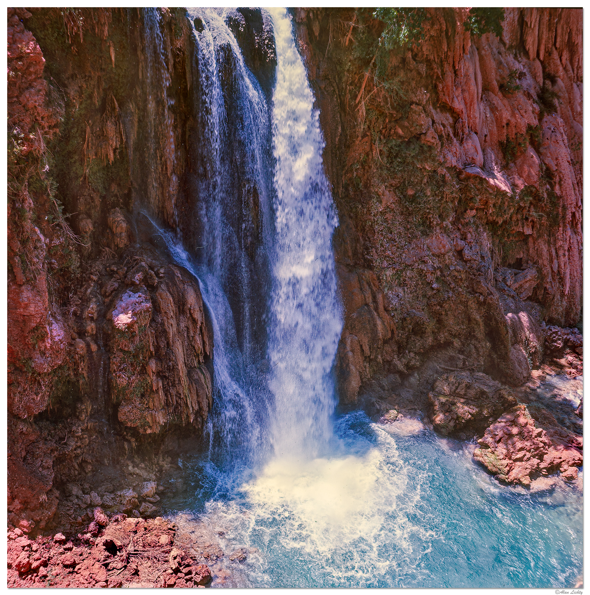
Navajo Falls in Havasupai Canyon 1967 - Minolta Autocord
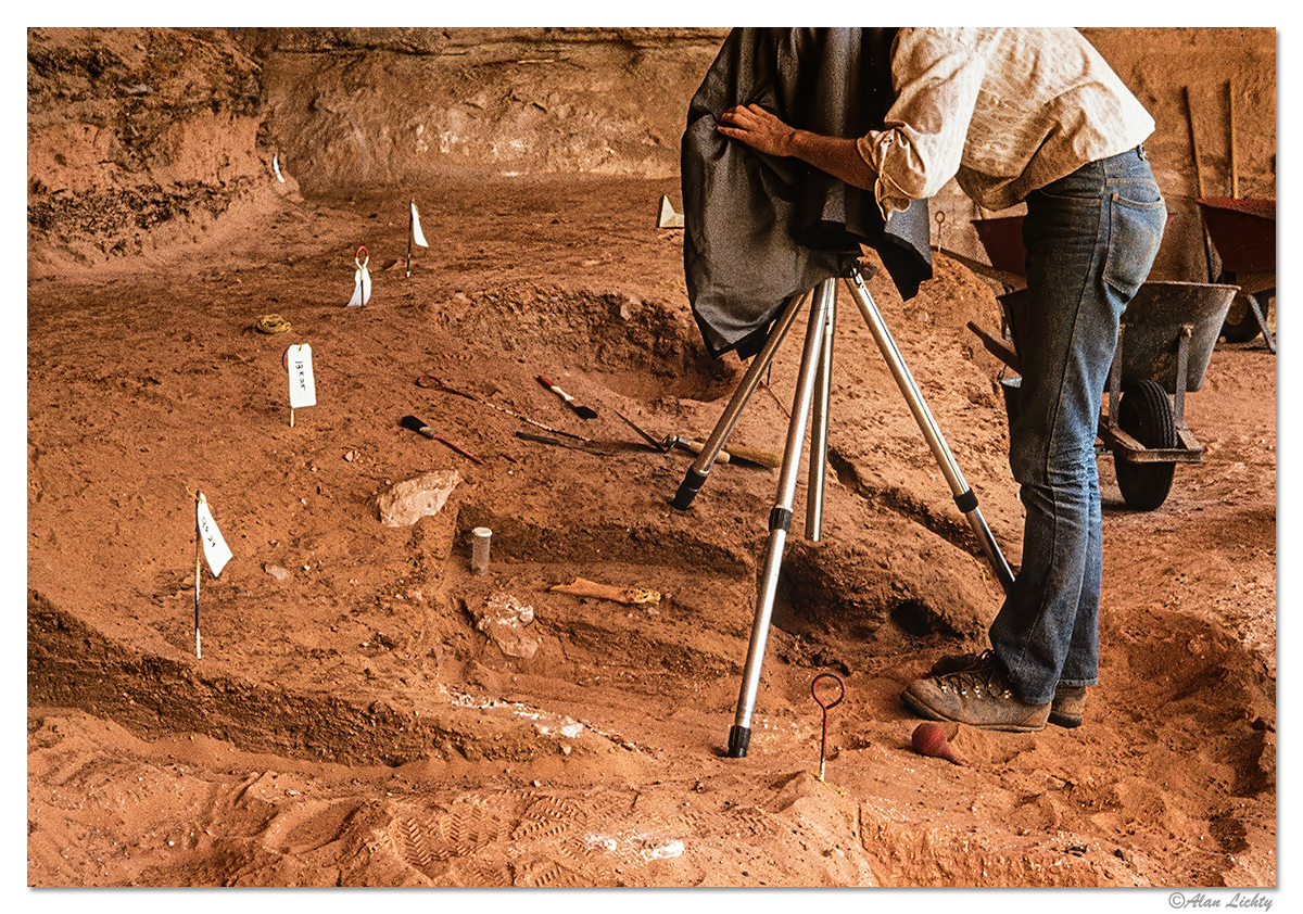
Excavations at Cowboy Cave 1974 - Pentax Spotmatic
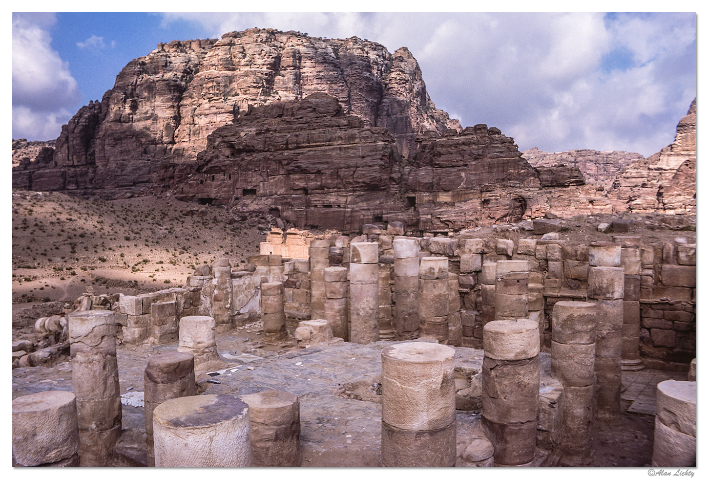
Umm al-Biyara in Petra, Jordan 1977 - Pentax Spotmatic
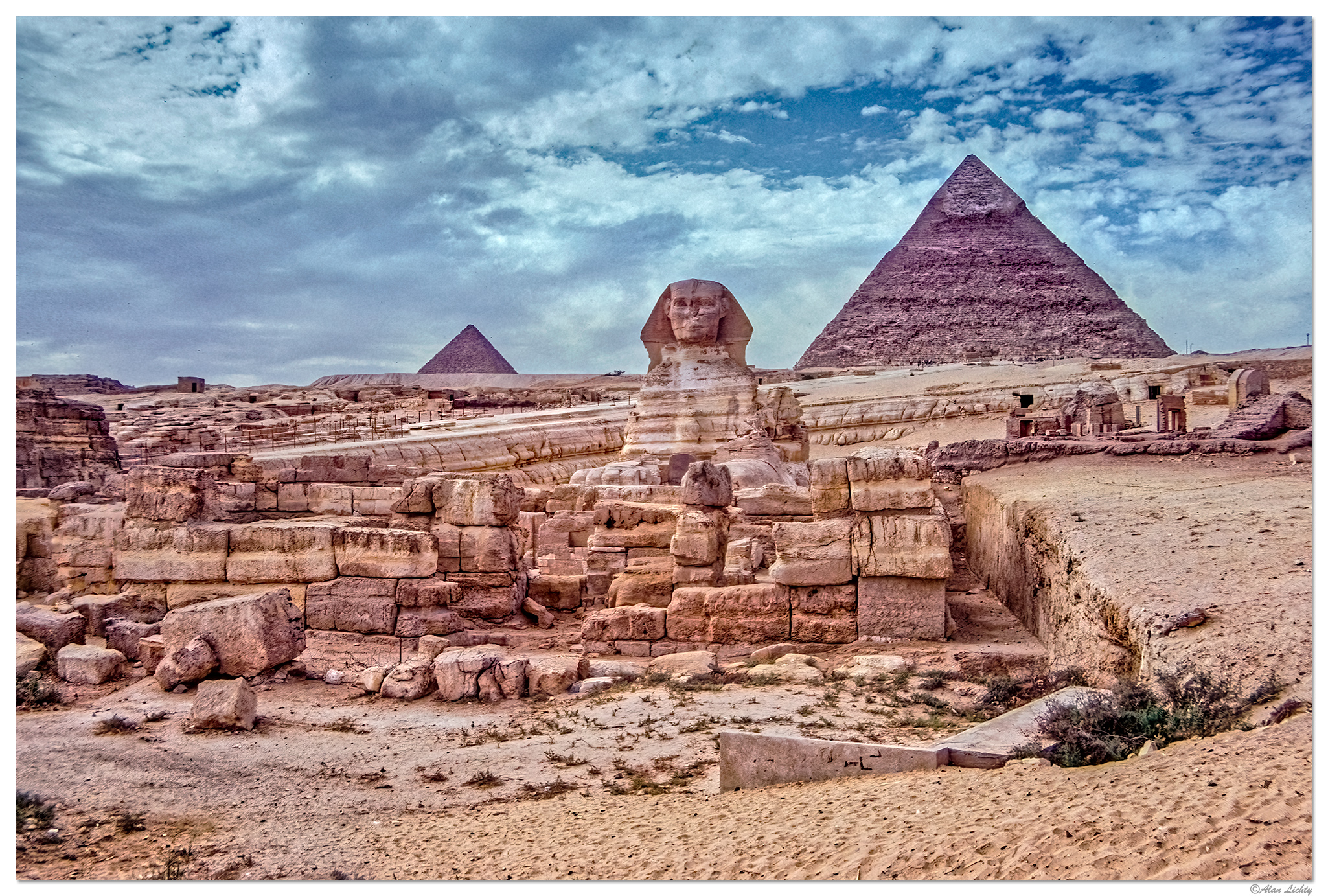
Giza 1977 - Pentax Spotmatic
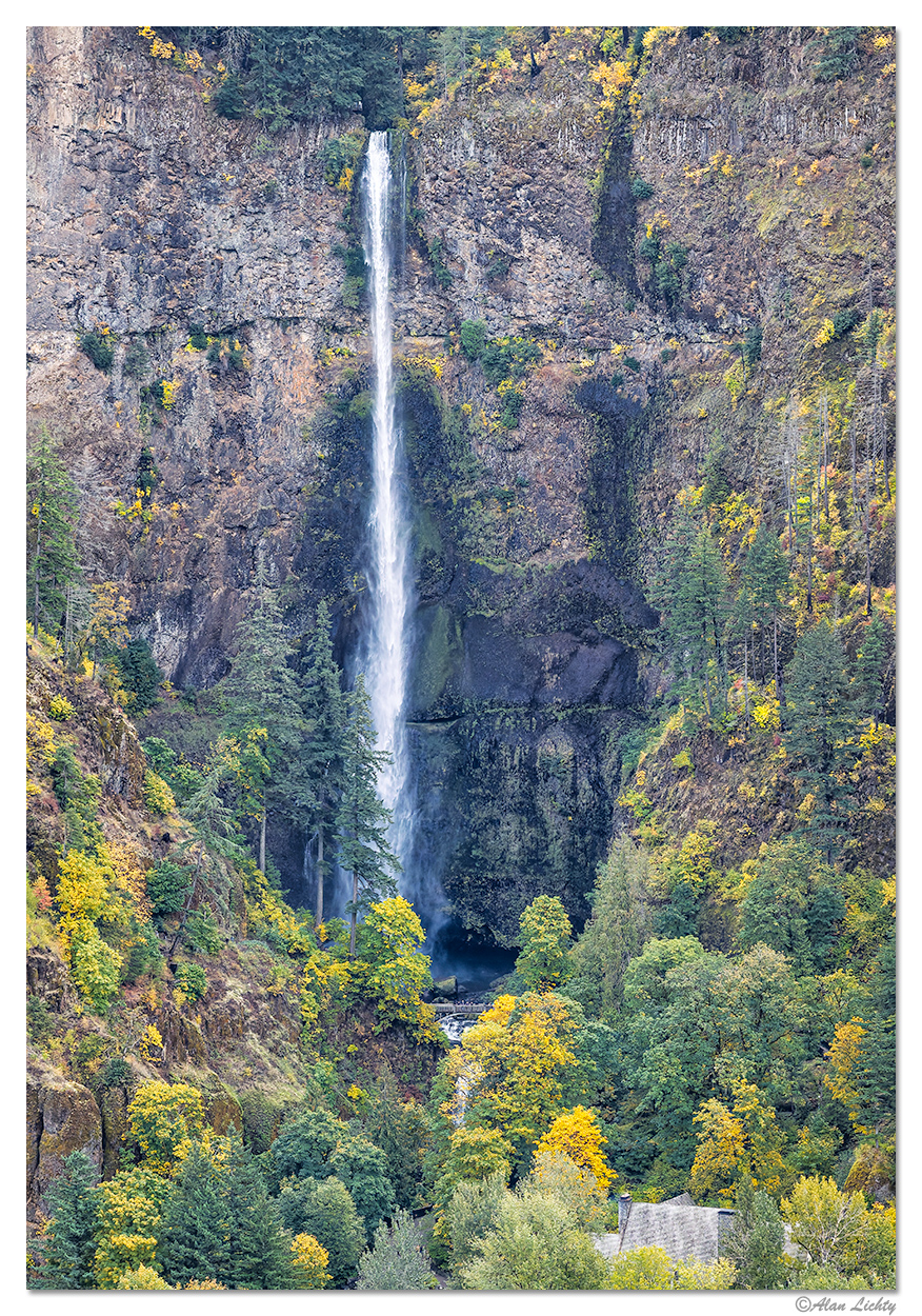
Multnomah Falls 2025 - DJI Mavic 3 Pro
Kentucky Creek Trail, Oregon 2025 - Canon R5MkII

In 1974 I started graduate school in Archaeology at the University of Utah and got formal training in using photography as a recording tool for excavation, artifact curation, and survey work. After several years of fieldwork in both Utah and the Middle East (Petra, Jordan and Egypt) I ended up working for the Utah Archaeological Center until 1994. My first major project at the Utah Archaeological Center in 1979 was to create a digital database of all of the survey and excavation records of work that had ever been done in the state of Utah on both public and private lands. Another PhD candidate and myself spent 3 years poring over all of the original records, photos and topo maps from every federal and state agency as well as the records on file at the U of U.
Some of the slides and photos we went through as part of that effort included images of places no one will ever see again including the photos taken by the teams that surveyed Glen Canyon in the 1950's before it was flooded by Lake Powell. Glen Canyon was without question the crown jewel of the Canyonlands area and to this day I resent the existence of Lake Powell. The University has been approached by magazines (including National Geographic) many times over the years for access to those survey slides but some legal reason has denied access. I felt lucky I got to go through them.
Most of my photography during that time was documentary in nature and quite a lot of it was using institutional cameras and film with everything catalogued and curated with either the Utah Archaeology Center or the Natural History Museum of Utah at the University of Utah. I traveled a lot in Utah as part of my work there and in a lot of places tourists still don't visit but none of it ever counted as vacation time. I bailed on the old thread mount system of the Pentax in the late 1980's and had a Nikon F2 for a few years but never really liked shooting with it. I switched over to a Canon EOS Elan and have been shooting with Canon EOS ever since.
I was finally ordered to take a real vacation since I had too much vacation time accumulated so my wife and I decided we should go visit a rain forest instead of the endless sagebrush and sandstone of Utah. Big mistake they made me do that because we immediately fell in love with the Pacific NW and decided to flee life behind the Zion curtain of Utah when I took a job in Vancouver Washington in 1998.
In 2001 I was unhappy with the photo labs in Vancouver so I decided to try editing my images on a computer instead so bought a Nikon Coolscan 4000 to scan my slides. I ended up using Silverfast software for scanning and Adobe Photoshop for edit work. While that did work for a while I noticed that Canon's new D60 DSLR with 6MP had almost the same number of lines as I was getting out of my slide scans at 4000dpi. All of the lenses I had for my EOS Elan would fit so I bought a D60 camera body and never looked back. Through the years since I have gone through quite a few EOS camera bodies (20D, 5D, 5D MkII, 6D, 5D MkIV, and now R5MkII). In an ironic twist I now use my digital cameras on a copy stand to scan my old slides.
I have always loved viewing aerial photography and added camera drones to my collection in 2022. I started with a DJI Air 2 but moved on with my current fleet consisting of a Mavic 3, Mavic 3 Pro, and a Mavic 4 Pro. My drones are quite capable of doing video work but I use them almost exclusively for still camera work and think of them as flying tripods. I don't really engage in commercial work with my drones but I have held an FAA Pt. 107 commercial drone pilot certificate for close to four years now.
I acquired almost a fetish for falling water ever since leaving the desert and while I do like to visit the Colorado Plateau area on occasions I have zero interest in moving back near there. My new love is for the deep dark forests of the Pacific Northwest and the amazing and almost endless waterfalls of the Columbia River Gorge less than an hour's drive from my house. I love the fact that I no longer depend on anyone's lab to process and view my work while being able to easily access the tens of thousands of captures I have taken through the years. Equally enjoyable for me is being able to participate in forums like this one where I can share my work and hopefully help others to improve their work and share it as well.
Navajo Falls in Havasupai Canyon 1967 - Minolta Autocord
Excavations at Cowboy Cave 1974 - Pentax Spotmatic
Umm al-Biyara in Petra, Jordan 1977 - Pentax Spotmatic
Giza 1977 - Pentax Spotmatic
Multnomah Falls 2025 - DJI Mavic 3 Pro
Kentucky Creek Trail, Oregon 2025 - Canon R5MkII
")