AlanLichty
Moderator
As landscape photographers we typically like to plan out our photo journeys - where to go, how to get there, when to leave to get the best colors/light at each shooting location, etc. Have you ever considered a photo journey where you had control over absolutely none of this beyond having your camera along to shoot what you see?
It is an interesting experience to try if you ever get a chance and this is the tale of a set of such destinations I shot in the fall of 1977 after coming back to the US from a summer in Jordan. I got a call from one of the guys I knew working on Utah archaeology and he asked me to join them for some archaeological survey work for a week or two.
Let me describe the random part of this since that is the real topic for this thread. The survey was on BLM lands as preliminary assessment of environmental impacts with an intent of permitting coal exploration. The swath of land was huge - from the Colorado border at I-70 all the way across the state to Cedar City - so someone decided what was needed was a random sample.
Without going into a lot of details about land surveying systems suffice it to say it's pretty easy to grid everything off into 10 acre plots (called a quarter quarter section) based on Township/Range/Section. They numbered every 10 acre plot and then had a computer generate a 3% sample of plots. No concern for where those landed other than they were all on BLM land.
We were sent out as teams of 4 with maps, a 4x4, tents, mess kits, camp stove, and lanterns with assigned sets of 10 acre plots to survey. Our team got 4 plots as our destinations. This is where things get interesting - your destination is a random plot of land. Getting to the survey plot is up to us to figure out but it always included 4-5 miles of hiking each way.
I am going to break this into 4 threads - each with one destination and set of images I took along the way. The first one is deep inside of the Book Cliffs north of Green River. Not certain I could reconstruct the path we took this many years later. There were no trails beyond animal paths for the last 2 miles.
Heading up into the Book Cliffs Range looking east over the Green River gorge.

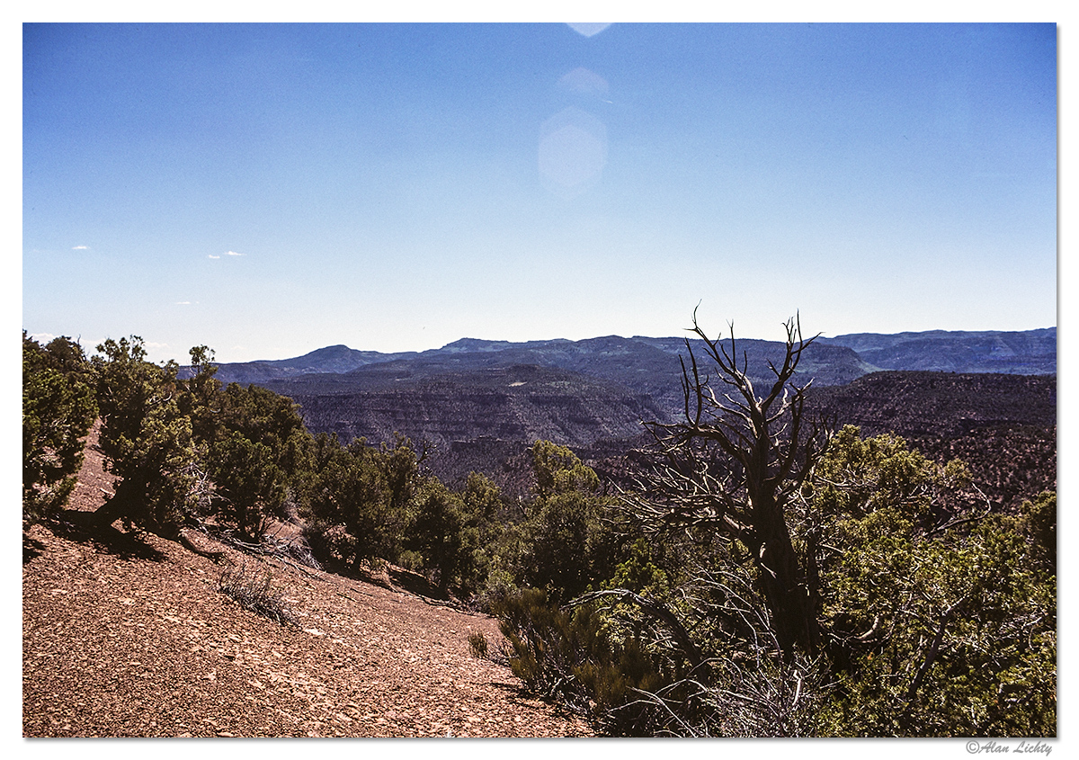
An overlook down to the Green River.

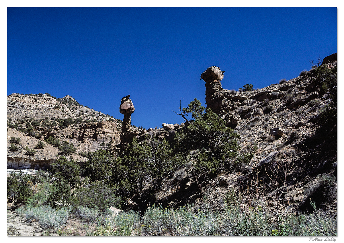
At the mouth of a small canyon in the high country of the range:
Our destination - turned out to be a ridge line with scattered pinion/juniper cover:
This is the view looking back to the south. The flatland area is the I-70 corridor and the green patch closest to the Book Cliffs is Green River.

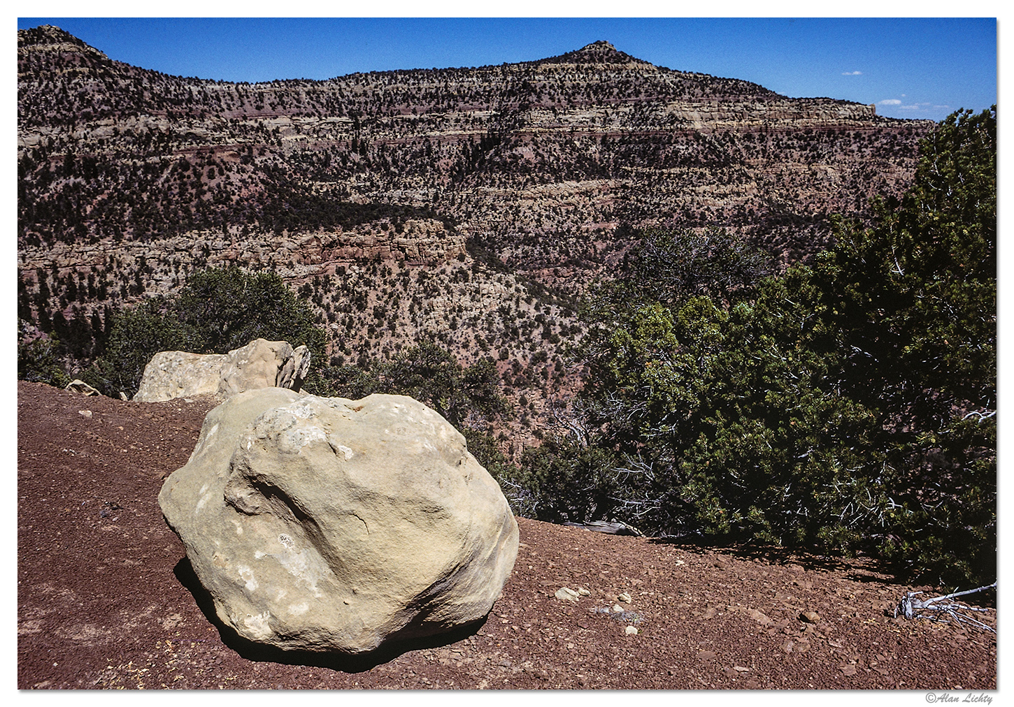
The image that was the most fun for me was some interesting color contrasts of a large stone that had fallen down from the strata above:
Next destination - the San Rafael Swell.
C&C always welcome.
It is an interesting experience to try if you ever get a chance and this is the tale of a set of such destinations I shot in the fall of 1977 after coming back to the US from a summer in Jordan. I got a call from one of the guys I knew working on Utah archaeology and he asked me to join them for some archaeological survey work for a week or two.
Let me describe the random part of this since that is the real topic for this thread. The survey was on BLM lands as preliminary assessment of environmental impacts with an intent of permitting coal exploration. The swath of land was huge - from the Colorado border at I-70 all the way across the state to Cedar City - so someone decided what was needed was a random sample.
Without going into a lot of details about land surveying systems suffice it to say it's pretty easy to grid everything off into 10 acre plots (called a quarter quarter section) based on Township/Range/Section. They numbered every 10 acre plot and then had a computer generate a 3% sample of plots. No concern for where those landed other than they were all on BLM land.
We were sent out as teams of 4 with maps, a 4x4, tents, mess kits, camp stove, and lanterns with assigned sets of 10 acre plots to survey. Our team got 4 plots as our destinations. This is where things get interesting - your destination is a random plot of land. Getting to the survey plot is up to us to figure out but it always included 4-5 miles of hiking each way.
I am going to break this into 4 threads - each with one destination and set of images I took along the way. The first one is deep inside of the Book Cliffs north of Green River. Not certain I could reconstruct the path we took this many years later. There were no trails beyond animal paths for the last 2 miles.
Heading up into the Book Cliffs Range looking east over the Green River gorge.
An overlook down to the Green River.
At the mouth of a small canyon in the high country of the range:
Our destination - turned out to be a ridge line with scattered pinion/juniper cover:
This is the view looking back to the south. The flatland area is the I-70 corridor and the green patch closest to the Book Cliffs is Green River.
The image that was the most fun for me was some interesting color contrasts of a large stone that had fallen down from the strata above:
Book Cliffs Contrasts
Interesting color contrasts on a ridge line in the Book Cliffs of Utah
Next destination - the San Rafael Swell.
C&C always welcome.