tims exercise

Beth

Well-Known Member
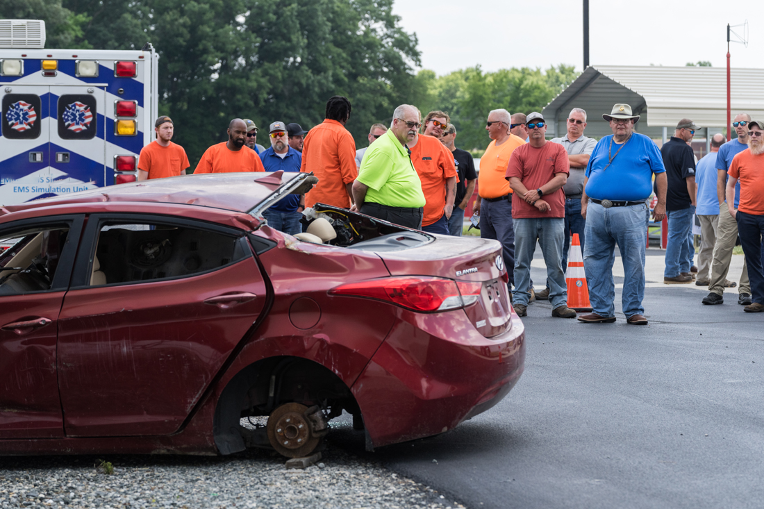
the annual multi-agency transportation incident management training that was held yesterday. held on the hottest day of the year, as usual. it was held at the state fire school, they supplied us with a mock crash scene. along with fire and ambulance, there were also state police reconstruction units from 2 states were present, hazmat teams and the dept. of transportation. i was there with the drone team.

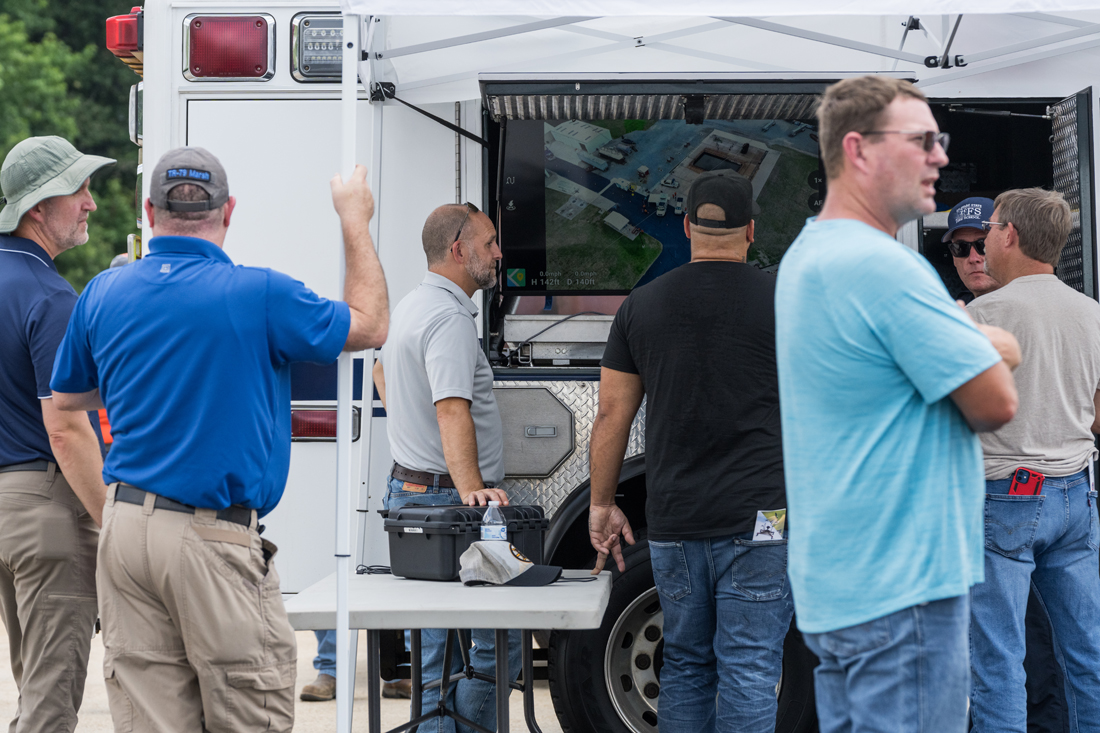
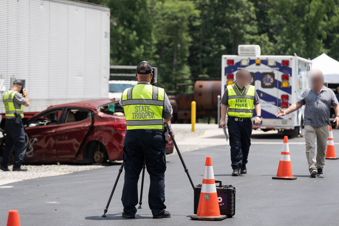
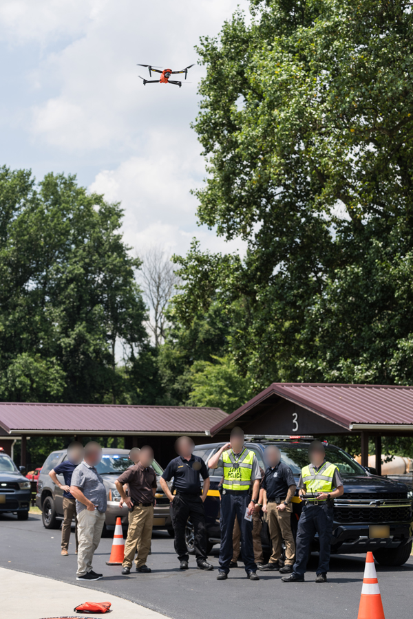
we setup our drone bus (seen in the 3rd pic) and featured the dji mavic 3t with airdata pushing video to the tvs on the outside of the drone bus and to the tvs in the fire school. state police worked the reconstruction scene using their lidar/survey equipment (currently 4 hr process) and with a new process using drone photos that create a 3d model and brings the investigation process down to 45 minutes. they fly using the autel evo ii.

TIMS Training 7-9-24-8.jpg


TIMS Training 7-9-24-16.jpg


TIMS Training 7-9-24-18.jpg


TIMS Training 7-9-24-23.jpg


TIMS Training 7-9-24-25.jpg
 

AlanLichty

Moderator
Are they using the lidar dat to make the 3d models?Amazing this is down to a 45 minute process now. Your TV display looks like a popular view of the scene.
 

Beth

Well-Known Member
Are they using the lidar dat to make the 3d models?Amazing this is down to a 45 minute process now. Your TV display looks like a popular view of the scene.
they're using lidar in the 4th pic. the drone stuff is all photogammetry. you can make a 3d map using either method. or, you can cross reference the two datasets in pix4d software. at that point you can measure items down to a millimeter of accuracy.

we were technically the most popular setup, but only because we were broadcasting via airdata inside the air conditioned fire school and the heat index was over 100 and it was less humid standing under the shower than outside. but the drone bus is pretty cool. it's an old hazmat response vehicle that we were given and outfitted for our purposes. multi-agency cooperation is something my state does really well.

should mention, you can get lidar data from the autel, but the ground unit gives you greater accuracy.
 

AlanLichty

Moderator
they're using lidar in the 4th pic. the drone stuff is all photogammetry. you can make a 3d map using either method. or, you can cross reference the two datasets in pix4d software. at that point you can measure items down to a millimeter of accuracy.

we were technically the most popular setup, but only because we were broadcasting via airdata inside the air conditioned fire school and the heat index was over 100 and it was less humid standing under the shower than outside. but the drone bus is pretty cool. it's an old hazmat response vehicle that we were given and outfitted for our purposes. multi-agency cooperation is something my state does really well.

should mention, you can get lidar data from the autel, but the ground unit gives you greater accuracy.
Fun stuff - I would have given body parts to be able to do that kind of site mapping when I was excavating at Petra back in the 1970's. We did map everything down to the millimeter by hand back then and there's nothing quick about doing it accurately. Add in the hours I spent at the drafting table (I still have my drafting pens) to produce the final maps and if you were lucky and uninterrupted and you might see the final result in a few weeks.
 

JimFox

Moderator
Staff member
What a hot but fun day! It's interesting to see a little behind the scenes view of your work. I have heard so much about what you do, it's pretty neat to see it in action like this.
 

Beth

Well-Known Member
Fun stuff - I would have given body parts to be able to do that kind of site mapping when I was excavating at Petra back in the 1970's. We did map everything down to the millimeter by hand back then and there's nothing quick about doing it accurately. Add in the hours I spent at the drafting table (I still have my drafting pens) to produce the final maps and if you were lucky and uninterrupted and you might see the final result in a few weeks.
drones and lidar would have definitely made that task quicker in the field, but you still might have spent weeks waiting on the software to render the final 3d map. we run small scenes and it still takes us all night sometimes. we regularly start the render before we leave, lock the computer and come back in the morning to an almost completed process.

What a hot but fun day! It's interesting to see a little behind the scenes view of your work. I have heard so much about what you do, it's pretty neat to see it in action like this.
it's a different job, i'll give you that. it's fun to take images of work related stuff i can actually show off.
 
Top Bottom