AlanLichty
Moderator
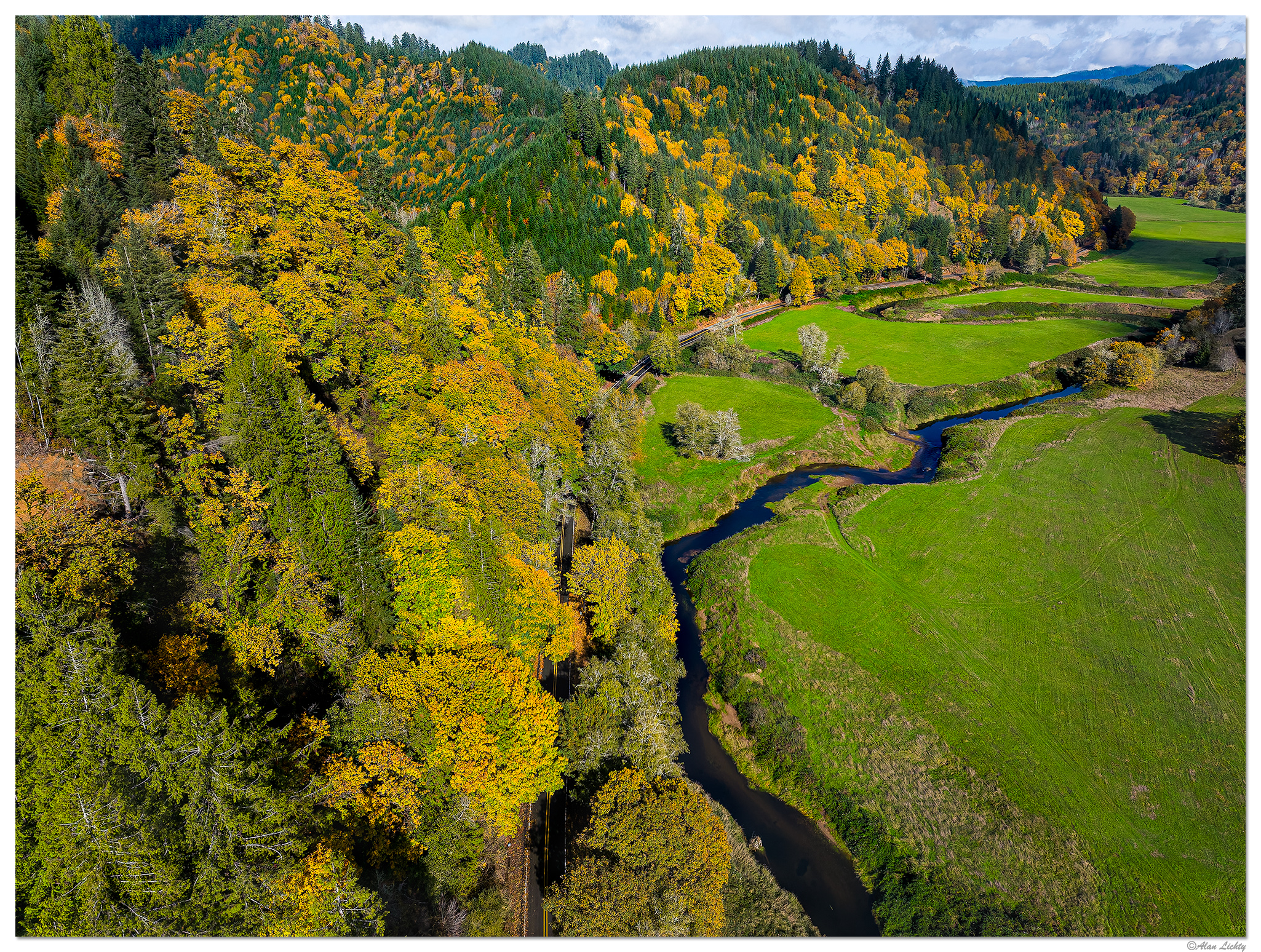
Looking upstream from the confluence of the North Fork and Smith Rivers. The worst part about this road was the lack of turnouts to stop and grab shots with all the fall colors. This area was pretty easy access for the early settlers coming up from the coastal estuary of the Smith and Umpqua Rivers. Clearing the forests for pastureland was quick and simple using the rivers to transport the harvested timber down to the mills in Garden City and Reedsport. On the one hand there is almost no old growth forest around this location but the deeply disturbed forests means more deciduous trees for fall colors. Single frame at 24mm.
C&C always welcome.
C&C always welcome.
")