A Storm Over Yonder

AlanLichty

Moderator
During the summer months a lot of the west gets thunderstorms but those storms get deflected by the Cascade mountain range and leave those of us who live west of the mountains dry. The weather radars indicated that there was an active set of thunderstorms just east of the Cascades last night so even though the skies were smoky but clear in the direction of the sunset I decided to see if I had a good view of the storms with my drone and that hunch turned out to be correct. The thunderhead over the storm pretty much covered the whole eastern horizon but the view of the Cascades was impaired by wildfire smoke. No way I could fit the thunderhead in a single shot so I went for a wide and tall panorama for the view. The result was a 20 shot panorama at 28mm covering a 180º view. The panorama below has an arc shape in the image but that is greatly exaggerated due to the lens angles when shooting from the horizon to almost directly overhead. Best viewed on a large monitor.
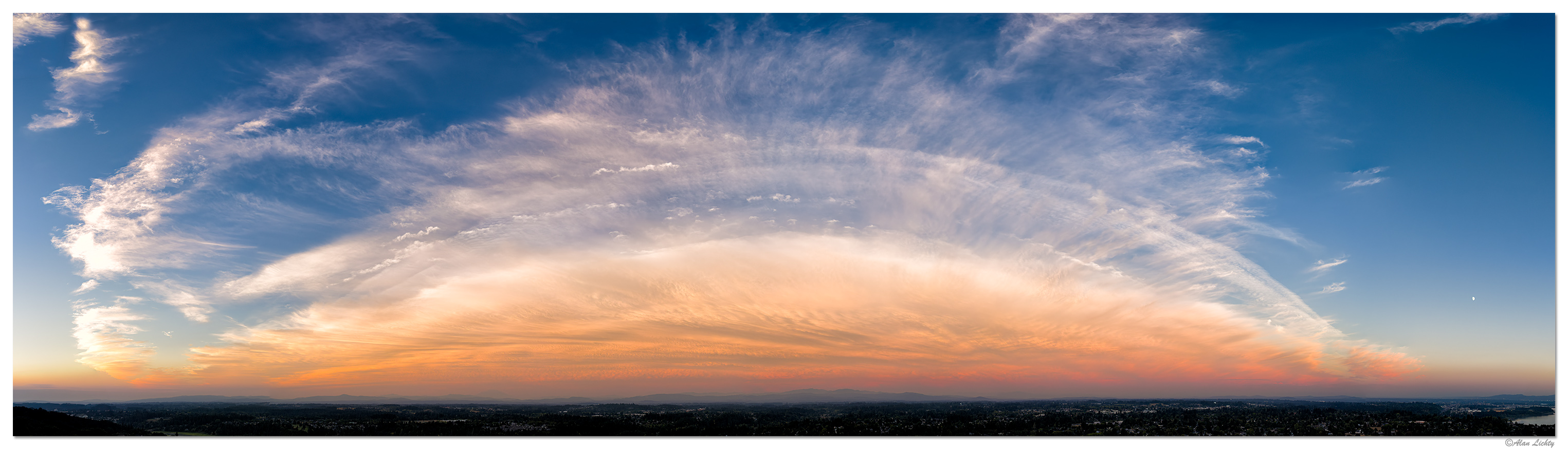
DJI_M4P_28P_SunsetThunderhead082126.jpg


C&C always welcome.
 

AlanLichty

Moderator
Wonderful, Alan. An unusual anomaly is creating a beautiful formation in the sky that I have never seen before.
Thanks Peter - as usual the storm is passing from right to left in this scene and never crossing the mountain range. The nice part here was that it happened after the sun dropped below the horizon behind me and the wildfire smoke in the area enhanced the colors.
 

AlanLichty

Moderator
Definitely an impactful image. The 180 view really works here to accentuate the sky with the wide lens exaggeration.
Thanks Jameel - you have to kind of guess at where you are pointing up in the sky for something like this. I scanned a little beyond each side of the frame I wanted for around 7 shots wide for each of 3 gimbal positions. Lightroom was only able to stitch 19 of the frames but that was enough for this crop.

The brown/orange band near the horizon is wildfire smoke over the Cascades. Somewhere behind that murk is Mt. Hood, Mt. Adams, and Mt. St. Helens.
 
Top Bottom