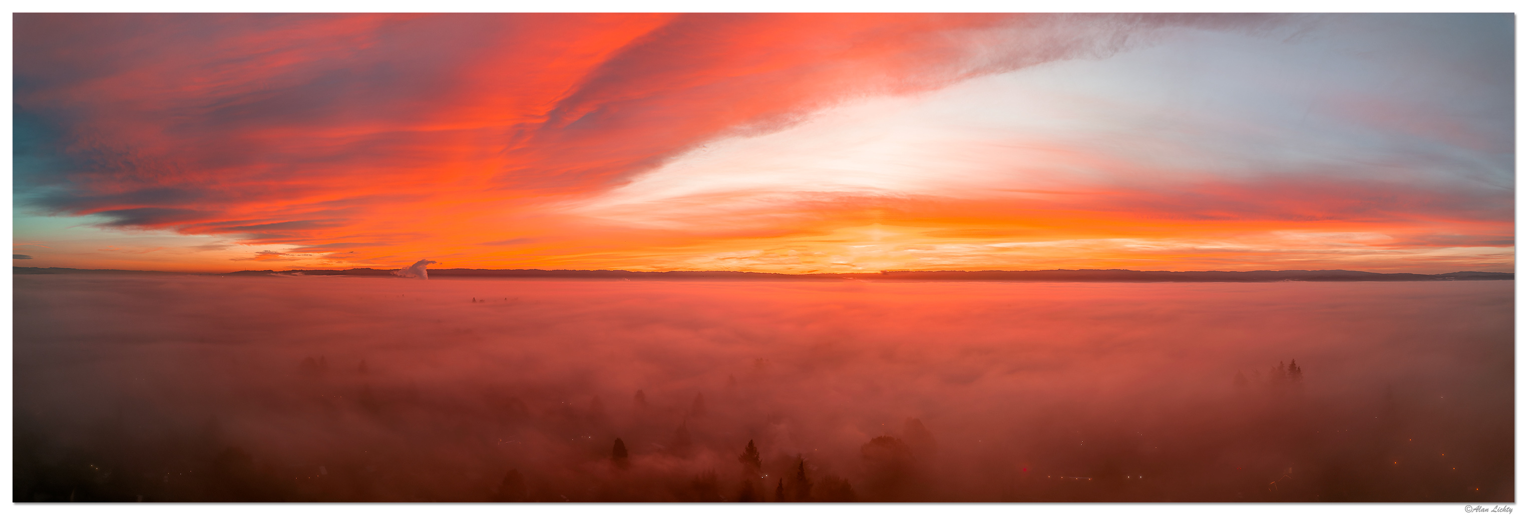
November Sunset

Jeffrey

Well-Known Member
Fabulous, Alan. The treetops really make it here, as well as the hint of civilization down below. Excellent imaging and processing.
 

AlanLichty

Moderator
Fabulous, Alan. The treetops really make it here, as well as the hint of civilization down below. Excellent imaging and processing.
Thanks Jeffrey - there were more treetops behind me since this view overlooks the Columbia River and the ground drops off looking in this direction. I shot this from directly overhead of my house instead of backing up to get more tree tops since I didn't really want to fly anywhere and then have to find my way back. Other shots I took that evening show lots more trees but not the great color show.
 

JimFox

Moderator
Staff member
This is nuclear! Now this is a once in 10 years sunset! Great job on capturing it.

Return to Home is your friend. It will fly back to you safely. I use it a lot, because it's easy to lose perspective on where it is.
 
This is a 4 panel panorama from a very nice sunset on a foggy evening in Vancouver. I did post some shots from this sunset a few weeks back but this is from earlier in the sunset color show. Click through for a more detailed version.

View attachment 55425

C&C always welcome.
Alan, I love the red clouds, the top half is what we will get this week: huge vapour saturated storm clouds on the way.

Oliver
 

AlanLichty

Moderator
This is nuclear! Now this is a once in 10 years sunset! Great job on capturing it.

Return to Home is your friend. It will fly back to you safely. I use it a lot, because it's easy to lose perspective on where it is.
Thanks Jim - Very much an amazing sunset. Even more amazing since it wasn't visible from the ground at all beyond a bit of a tint in the fog. Flying anywhere away from where I was would immediately put you afoul of VLOS flight rules. Visibility straight up was OK but from the ground even moving 1-200' in any direction would be beyond visibility. You would have neither a clear view of the drone or situational awareness of what is going on around the drone since you wouldn't be able see that airspace from the launch point. This is a topic that generates some rather spirited discussions on the Mavic Pilots Forum.
 

AlanLichty

Moderator
Alan, I love the red clouds, the top half is what we will get this week: huge vapour saturated storm clouds on the way.

Oliver
Thanks Oliver - not a lot of opportunities for sunsets like this right now. I might get a sunrise tomorrow (rain by sunset) and then the forecast is rain every day for the next two weeks up here.
 

Jeffrey

Well-Known Member
Alan, this so expresses the ability to be more of a photographer by using a drone. Most people wouldn't think this has the 'drone' look. It doesn't. It just works. I'm anxious to get out with my new bird but right now we have reached 5.5" of rain just today and it's not stopping for a while.
 

AlanLichty

Moderator
Alan, this so expresses the ability to be more of a photographer by using a drone. Most people wouldn't think this has the 'drone' look. It doesn't. It just works. I'm anxious to get out with my new bird but right now we have reached 5.5" of rain just today and it's not stopping for a while.
Thanks Jeffrey - I consider that a compliment since my goal with a drone is to simply have another place to put a tripod to shoot. When I look at my flight logs on AirData they all look similar in that I go to some spot in the sky and then just sit there shooting in all directions which is exactly what I do when I spread out my tripod legs on the ground in the first place. This is the flight log for this particular sunset as shown on a map. Each triangle represents a single image capture with the wide part showing the gimbal heading for the shot.

1673304690554.png


I call this a periscope flight since I just went up and then shot the views without flying anywhere else. I do these a lot in the forests since all I can see on the ground are tree trunks.

5.5" just today?? You could shoot waterfalls coming off your roof with rain like that.
 

JimFox

Moderator
Staff member
Thanks Jim - Very much an amazing sunset. Even more amazing since it wasn't visible from the ground at all beyond a bit of a tint in the fog. Flying anywhere away from where I was would immediately put you afoul of VLOS flight rules. Visibility straight up was OK but from the ground even moving 1-200' in any direction would be beyond visibility. You would have neither a clear view of the drone or situational awareness of what is going on around the drone since you wouldn't be able see that airspace from the launch point. This is a topic that generates some rather spirited discussions on the Mavic Pilots Forum.
That makes sense with the fog. As I have mentioned before the Mini 2, I can't see it once it gets about 100 feet away, much less the 5 mile range or whatever it is. And in practicality I think about 1 mile is the most I can get before there are transmission errors anyway. But typically, even if I can't see the drone anymore, say in the 800 to 1000 foot distance away, I can see the area around it, back to that situational awareness. If a helicopter or a low flying airplane was coming in, I could spot it and immediately lower the altitude of my drone. Even if I can't directly see my drone anymore, I have an idea usually where it is, though there are times one can lose where exactly it is because 1 hill starts to look like another hill. I will have a general idea, but not know exactly. With fog, thinking about it, I totally get that you wouldn't be able really know where it was as the ground would look way to similar, just more fog.

How thick was the fog. I just thought of this, as you are gaining altitude are you paying attention to the altitude that the fog ends?
 

AlanLichty

Moderator
That makes sense with the fog. As I have mentioned before the Mini 2, I can't see it once it gets about 100 feet away, much less the 5 mile range or whatever it is. And in practicality I think about 1 mile is the most I can get before there are transmission errors anyway. But typically, even if I can't see the drone anymore, say in the 800 to 1000 foot distance away, I can see the area around it, back to that situational awareness. If a helicopter or a low flying airplane was coming in, I could spot it and immediately lower the altitude of my drone. Even if I can't directly see my drone anymore, I have an idea usually where it is, though there are times one can lose where exactly it is because 1 hill starts to look like another hill. I will have a general idea, but not know exactly. With fog, thinking about it, I totally get that you wouldn't be able really know where it was as the ground would look way to similar, just more fog.

How thick was the fog. I just thought of this, as you are gaining altitude are you paying attention to the altitude that the fog ends?
The fog in this case was about 75' from ground level where I live. Out in the middle of the Columbia River in the middle of this scene it would be around 300' since the river is at sea level. I always track elevation on launch as I need about 80' to clear the trees around the block I live on. There are some taller than that but not right near my house.

VLOS as defined by the FAA is all about situational awareness of where your drone is in the sky and what else is going on in that airspace. There are some drone pilots that insist you should always be looking at the aircraft but that's not what the FAA guidelines actually state. The FAA expects that you will be looking both in the area of the drone in the sky as well as looking down at your control console. If you can look up from your console and know where your drone is in the airspace you are fine. For my case with the fog above any movement from directly overhead decreases my ability to see the drone's airspace.

Manned aircraft SHOULD be at least 500' above ground level but I have seen more than a few occasions where someone is flying lower in a private aircraft. At least with my Mavic 3 I get warnings when aircraft are in the area when they have ADS-B transmitters installed. When I am out at the coast shooting over open water there are also fairly low flights of the Coast Guard helicopters to keep an eye out for. With usual winter conditions they are surprisingly difficult to hear coming. The Columbia River Gorge is more complex since I am often flying from higher elevations and aircraft flying 500' above the Columbia are 300' below me if I go out from the cliffs. I am supposed to stay within 100' of the cliffs in those conditions.
 
Top Bottom